| .forgejo/workflows | ||
| cache.example | ||
| style | ||
| .gitignore | ||
| generate_map.py | ||
| LICENSE | ||
| map.readme.png | ||
| README.md | ||
| requirements.txt | ||
erfamap
Generate a map for https://www.ccc.de/regional from Wikidata, Nominatim and the doku.ccc.de Semantic MediaWiki data.
TL;DR
pip3 install -r requirements.txt
export DOKU_CCC_DE_BASICAUTH=username:password
./generate_map.py --rename 'Frankfurt am Main' 'Frankfurt' --update-erfalist
ls -al out/
Installation
- Create a Python virtualenv:
python3 -m virtualenv venv - Enable the virtualenv:
. venv/bin/activate - Install the dependencies:
pip install -r requirements.txt
Instead of following these steps, you could also install the dependencies from your OS' package manager.
Usage
For a quick test run, point the script at the cache.example directory:
./generate_map.py --cache-directory cache.example
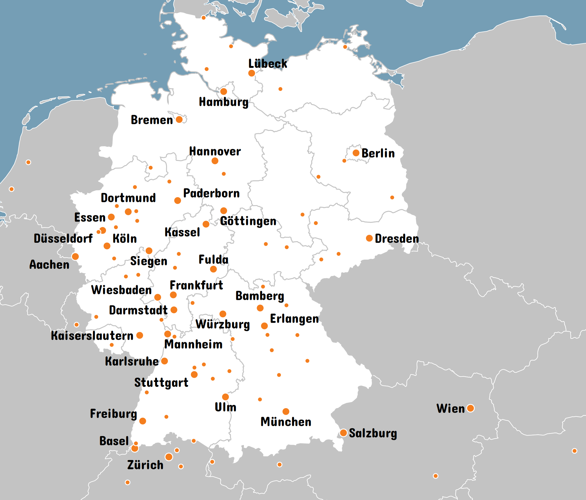
This creates the following files in out/:
map.svgis the map as a SVG image, with clickable links.map.pngis the map as a PNG image.imagemap.htmlincludes map.png, along with a HTML image map that makes the dots and labels clickable.erfamap.htmlincludes map.svg, with map.png and an imagemap as fallback.style/contains the stylesheet and font.
If the wrong font is used in the PNG, make sure the chosen font is installed on your system. (CairoSVG does not support the use of @font-face in style sheets.)
Usually you'll want to keep the border cache, but renew the Erfa & Chaostreff list from time to time:
./generate_map.py --update-erfalist
For this, you need to provide the HTTP Basic Auth credentials to doku.ccc.de via an environment variable:
export DOKU_CCC_DE_BASICAUTH=username:password
A run without cache takes some time as it fetches all data from their sources:
- Get a list of countries in Europe and federal states in Germany from Wikidata.
- Download all these countries' and states' border shapes from Wikimedia Commons.
- Get a list of Erfas & Chaostreffs from the doku.ccc.de Semantic Mediawiki API.
- Resolve all POIs' (Erfas & Chaostreffs) street addresses' to geocoordinates using Nominatim, rate limited to 1 request per second as per Nominatims usage policy.
Use the cache whenevery you don't need to update country borders or hackerspace locations. Otherwise, both Wikidata and Nominatim will start rate limiting pretty quickly. (And caching is actually required by Nominatim's acceptable use policy).
License
Unless otherwise noted, the contents of this repository are licensed under the MIT License (See LICENSE).
Fonts
The font contained in style/concertone-regular.ttf was created by Johan Kallas (johankallas@gmail.com) and is licensed unter the terms of the SIL Open Font License v1.10.
Geoshape Data
The geoshape data contained in cache.example is in the public domain.